Read the whole route before you go
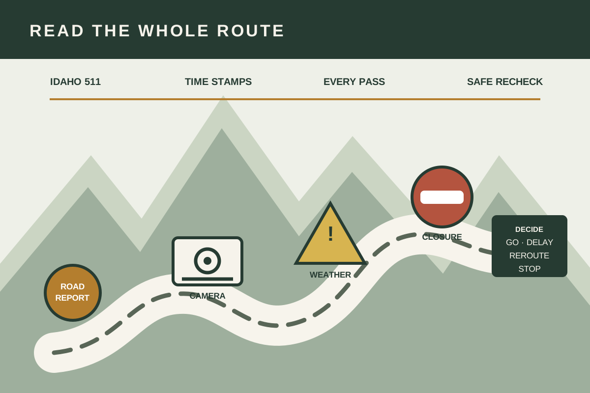
“How are the roads?” sounds like one question. An Idaho winter trip can make it five: Is the first highway open? What is happening on the pass? Is freezing precipitation moving into the destination? Has a crash closed the alternate route? Will the conditions still hold when the vehicle reaches the highest segment?
Idaho 511 brings road conditions, closures, incidents, cameras, weather stations, forecasts, message signs, rest areas, mountain passes, and restrictions into one official traveler-information service. The tool is most useful when you read the route in layers and make a decision before the difficult segment—not when you ask one camera to predict the whole drive.
The two-minute answer
- Open Idaho 511 before starting the vehicle.
- Check every highway segment, pass, closure, incident, and current time stamp.
- Compare road information with the National Weather Service forecast and alerts along the route.
- Treat cameras as local snapshots, not proof that the next mile is clear.
- Write the conditions that trigger a delay, official alternate route, or turnaround.
- Recheck only from a safe parking place or through a passenger.
Trace the entire route, not just the destination
Start with the highways and decision points, not a city-to-city travel time. Write the main route in segments: home to highway, valley section, pass or canyon, state line, and final local road. Mark the points where an official alternate route branches. If the trip crosses Oregon, Washington, Montana, Wyoming, Utah, Nevada, or Canada, add that jurisdiction’s official traveler-information system; Idaho 511 does not report every condition beyond Idaho.
Pay special attention to changes in elevation and exposure. A dry valley camera does not describe a shaded canyon or a pass hundreds of feet higher. Blowing snow can affect an open plateau while a nearby sheltered segment looks manageable. Freezing rain can create a different problem than deep snow. The route should therefore be checked as a chain whose weakest segment can change the whole decision.
Current public questions about Idaho winter travel often ask for a single “best route.” The useful answer is conditional. The better route can change with snowfall, wind, a crash, plowing, an avalanche closure, or conditions across a state line. Build a route comparison from official data at the time you will travel rather than treating a familiar road as permanently safer.
Read Idaho 511 in layers
The Idaho 511 map separates information into layers. Turn on only what answers the next decision so the map stays readable. The road-condition layer uses the statuses Good, Fair, Difficult, Closed, and No Report. Open the segment details and read the weather and special conditions rather than making a decision from color alone.
A route-layer sequence
- Closures: look for closed segments and future closures first. A closure ends the question for that route.
- Road conditions: open each segment and note its status, description, and last-updated time.
- Incidents and roadwork: check crashes, obstructions, lane restrictions, and planned work that can create delays.
- Cameras: inspect selected locations before and after passes, junctions, and exposed areas.
- Weather stations and alerts: add temperature, precipitation, wind, and current hazard information where available.
- Message signs and rest areas: note current instructions and a safe place to stop before the next decision point.
No Report is unknown, not good. It means the displayed road-condition layer has no current report for that segment. It does not mean pavement is dry or the road is unrestricted. Use the forecast, alerts, nearby cameras, closures, and other official information, then choose a conservative plan when a critical segment remains unknown.
Check the time stamp. A report can be accurate for when it was entered and still lag a fast-moving squall, freezing drizzle, or collision. Idaho Transportation Department says road conditions are updated continually and uses 511 for current travel planning, but winter weather can change between reports. Freshness belongs in the decision.
A camera answers “what was visible here?”
A camera is valuable because it makes surface cover, visibility, traffic flow, and plow activity visible at a specific place. It cannot show traction, black ice, wind around the next bend, or conditions miles away. First confirm the location, direction, and image time. Then compare a sequence of cameras across the route instead of selecting the clearest frame.
| Camera clue | Useful reading | Limit |
|---|---|---|
| Pavement looks dark | May be wet or partly clear at that point | Black ice and treatment cannot be confirmed visually |
| Lane markings visible | Shows local visibility and cover | Does not establish stopping distance or traction |
| Plow in frame | Confirms maintenance activity at that moment | Does not mean the entire route has been treated |
| Light traffic moving | Shows vehicles recently passed the location | Does not prove the road is open beyond the frame |
| Old or unavailable image | Signals missing evidence | Should never be treated as a clear-road image |
Save a set of repeat checkpoints in My Idaho 511 if the service fits the household’s needs, or write a plain list of camera names and road segments. Idaho 511 can provide route notifications through a user account, but a notification is an additional path, not a replacement for a deliberate pre-trip check.
Road reports describe now; the forecast describes change
Open the relevant National Weather Service forecast and any watch, warning, or advisory for home, the highest route segment, and the destination. Read the timing, snow or ice, wind, visibility, temperature trend, and impact language. Our Idaho winter alert guide explains how to turn those products into action.
Match the forecast to the travel clock. Conditions that are fair at 2 p.m. can become difficult after sunset, during a frontal passage, or as temperatures fall through freezing. A snow squall warning is especially time sensitive. The National Weather Service says snow squalls can cause sudden whiteout visibility and rapid icing; delay entry to the affected road when possible.
Do not build a plan around beating a closure. If officials are preparing to close a route or the forecast places dangerous conditions in the arrival window, delay. A vehicle near the gate can still be exposed to crashes, stalled traffic, and rapidly worsening weather.
Choose go, delay, reroute, or stop
Write the decision thresholds before departure. That prevents schedule pressure from moving the line after conditions worsen.
| Decision | Evidence that supports it | Next action |
|---|---|---|
| Go with checkpoints | Route is open; reports, cameras, forecast, vehicle, and driver agree; no critical unknown segment | Share the route and arrival window; recheck before exposed sections |
| Delay | Warning overlaps the trip, conditions are deteriorating, visibility is poor, or the driver lacks winter experience | Choose a review time after the hazard, not an arbitrary short wait |
| Use an official alternate | Main route is impaired and an open, maintained alternate has been checked end to end | Recalculate fuel, daylight, border-state conditions, and safe stops |
| Stop or turn back | Closure, unsafe visibility, worsening traction, vehicle trouble, fatigue, or conditions exceed the written threshold | Use the next safe public stopping place; tell the contact the plan changed |
A longer maintained highway may be a better winter choice than a short unpaved or seasonally maintained road. Never drive around a closure barrier or follow a navigation app onto an unverified back road. An alternate is not real until official sources show it open and the driver has checked its entire length.
Four-wheel drive and all-wheel drive can help a vehicle accelerate; they do not cancel stopping distance, tire limits, visibility, gravity, or driver experience. If the driver is not comfortable with the reported conditions, delay. A plan that respects experience is more useful than a gear list that assumes confidence.
Set recheck points without creating distracted driving
Idaho 511’s phone help advises calling before travel, asking a passenger to check, or pulling over safely. The driver should not study a phone, app, or camera feed while moving. Choose safe public places before a pass or major junction: a town, staffed fuel stop, rest area shown open, or another legal parking location well away from traffic.
- Recheck before departure after the vehicle is loaded.
- Recheck before the first major elevation change or route split.
- Recheck after a long stop because reports and forecasts may have changed.
- Recheck when a message sign, alert, traffic backup, falling temperature, or visibility change provides new evidence.
- Stop the trip when no safe recheck location remains ahead of the hazard.
Agree on a check-in time with someone who is not traveling. Share the planned route, official alternate, vehicle description, departure, expected arrival, and the point at which that person should seek help. Do not post the household’s empty-home schedule publicly.
Prepare for a delay without planning to push through
A route check reduces exposure; it does not remove it. Idaho’s driver manual advises telling someone the route and expected arrival time, carrying winter supplies, and staying with the vehicle when stranded in heavy snow. A vehicle is easier to locate and provides shelter. Call 911 for an immediate threat, crash, medical emergency, or unsafe location.
Use the Idaho winter car kit guide to match supplies to passengers and trip length. Before a winter trip, also check tires and pressure, fuel or charge, battery condition, lights, wipers, washer fluid, defroster, brakes, and recovery limitations. Clear snow from windows, lights, roof, hood, and sensors. Secure cargo so hard objects do not become projectiles.
If stopped by a closure, keep fuel or battery reserve and follow official directions. Do not idle in an enclosed place. In snow, keep the exhaust pipe clear before running an engine and use the vehicle’s manual and official emergency guidance. Carbon monoxide has no smell; a blocked exhaust can make the passenger compartment dangerous.
Print or copy this route card
- Main route and highway numbers: ______________________________
- Highest or most exposed segment: _____________________________
- Official alternate checked end to end: ________________________
- Departure / expected arrival: _________________________________
- 511 conditions and time stamps: ______________________________
- NWS alerts and timing: _______________________________________
- Go / delay / reroute / stop threshold: ________________________
- Safe recheck locations: ______________________________________
- Travel contact and check-in time: _____________________________
Common Idaho 511 mistakes
- Checking one camera: use a route sequence across elevations and decision points.
- Reading No Report as good: treat it as missing evidence.
- Ignoring the update time: fast weather can outrun a report.
- Looking only at Idaho: add the official system for every state the route enters.
- Trusting an app detour: verify that the alternate is open, maintained, and appropriate.
- Rechecking while driving: use a passenger or a safe parking place.
- Leaving without a stop rule: write the threshold before schedule pressure builds.
Questions before departure
What does No Report mean?
It means the current road-condition layer does not provide a report for that segment. It does not mean clear or safe. Look for additional official evidence and use a conservative decision when the missing segment is critical.
Can a camera prove the road is open?
No. Closures and road reports answer that question. A camera adds a local, time-stamped visual observation.
How often should I check?
Check before departure and at planned safe locations before major passes, exposed segments, or route decisions. Check again whenever an official alert, sign, or changing condition gives new information.
Should I use a back road around a closure?
No. Do not cross a closure or improvise an unverified detour. Use an official open alternate only after checking it end to end.
Official sources checked
- Idaho 511 and its road-condition table — current closures, reports, cameras, weather information, and route tools.
- Idaho Transportation Department travel information and winter driving guidance — official traveler resources and winter preparation.
- Idaho 511 phone help — safe ways to check by phone and route-notification information.
- Idaho Driver’s Handbook — winter travel planning and stranded-motorist guidance.
- National Weather Service winter hazards — current winter hazard definitions and travel actions.
- Ready.gov winter weather — household and vehicle preparation for winter storms.
Reviewed October 20, 2026. Road reports, cameras, closures, and forecasts change. Use current official information and follow law enforcement, transportation crews, emergency alerts, and posted closures.
More official Idaho information and local contacts →